7 days, 7 states, 7 mountains - AUSTRALIA

In May 2017, Red Bull endurance athlete and dual Olympian, Courtney Atkinson, set out to complete one of the craziest running adventures around Australia.
AN AUSTRALIAN RUNNING PROJECT
#OneWeekOneAustralia
Inspired by the 'State 8' – a hiking challenge that involves summiting Australia’s highest peak in each state or territory in the course of a person's lifetime – Courtney wanted to see how many of the State 8 ascent records he could break in just 7 days. Hiking up them? NO, he wanted to race!
So that’s exactly what he did.
THE STATISTICS
Running
25 hours of running in 7 days7 Ascents: Australia's Highest Peak in every State or Territory72km of that running UPHILL at RACING pace7.7km of vertical gainFastest known times (FKT) up multiple mountainsMount Kosciuszko was the only climb Courtney had seen before this project. The ascents were navigated using Polar Route Guidence with GPS mountains having no trails or limited tracks.
A runners stat - you could say my total running hours equate to a 300km+ running week if the 25hrs were run along flat roads at jogging pace (app. 5mins/km). But think, Courtney, attacked the climbs at racing heart rate equivalent of him running a 30-31min 10km
Travel

Mount Meharry Camping State 8 Mountain
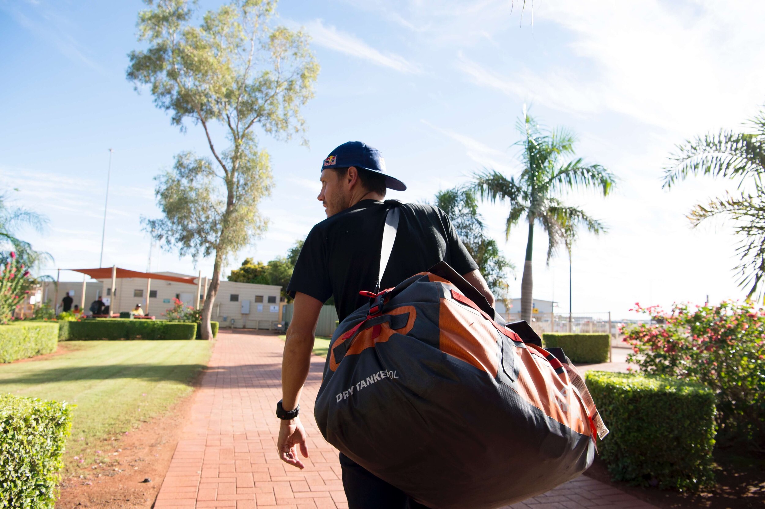
11 flights - 23hrs15mins - 13,023km equal to flying Sydney - DubaiDriving 2265 kmabout half the distance across AustraliaAcross jungle, snow, and desert. In both day & nightCrew = Two. Courtney and travel/film companion Shane Barrie. Courtney ran the mountains ALONE. Shane would stay at base, for safety, and help film the journey.Carrying everything in a 120L Kathmandu Tanker Duffel weighing only 20kg. Being self-sufficient for the whole trip. Kathmandu supplied all top of range lightweight camping gear.Eating was on the go. Breaky in the car. Usually muesli. Quick snack from Qantas Clubs while rushing through airports each day. Otherwise, quick trips into Coles for hot chook and bread rolls when out camping at the base of mountains.
"90% of time I was running alone without mobile reception. I carried a sat phone on the bigger remote climbs but that’s no help if you’re knocked out."
MOUNT BARTLE FRERE

Running Mount Bartle Frere Summit

MOUNT BARTLE FRERE GPS STRAVA
Location: Sugar Cane Region of Northern Queensland
Access: 60min drive out of Cairns, Queensland. Carpark at Trail Head. At the entry to Josephine Falls.
Sleep: Camped out on private property in Babinda
Terrain: 100% trail, very steep, very rooty, slippery and damp. Leeches. The Big boulder field near the top was the highlight. Clouded in at the summit.

Josephine Falls, Mount Bartle Frere Queensland
Difficulty: 9/10
BIMBERI PEAK

Bimberi Peak Strava Data - Courtney Atkinson
Location: (ACT) Australian Capital Territory, at the northern end of the Snowy Mountains
Access: 3.5hr drive from Canberra finishing down a 32km unsealed road. Start at the gate across Pocket Saddle Rd.
Sleep: Camped 1km from start at Old Camp Access Track
Terrain: Undulating Fire Roads until the last 3km which was off track following rock cairns up steeper rocky ground. Clouded in at the top. Check out Oldfields Hut. Great spot to camp.

Courtney Atkinson RedBull State 8
Difficulty: 6/10
MOUNT KOSCIUSZKO

Running Mount Kosciuszko State 8

MOUNT KOSCIUSZKO GPS STRAVA
Location: Top of Australia, New South Wales
Access: Drive up the mountain range from Jindabyne, past Perisher Ski Resort onto Charlotte's Pass carpark. The trail starts here.
Sleep: Nil - This was the 2nd run of the day after Bimberi. The two runs nearly combine to make a marathon 42km.
Terrain: Well signed, easy to follow fire roads all the way to top. Although the highest point in Australia, it's the easiest summit too reach. But still, hard yakka if racing the 9km to the top. Can be covered in snow.

Courtney Atkinson Mount Kosciuszko Aussie State 8
Difficulty: 3/10
MOUNT BOGONG

MOUNT BOGONG GPS STRAVA
Location: Close to the towns of Mt Beauty and Bright in Victoria.
Access: Start at the base of Staircase Spur Summit Walk. A drive down a 4x4 track after leaving the sealed road. Close to 5hrs driving all the way south from Charlotte's Pass.
Sleep: Hotel in snowy mountains. There is the option to camp at Mountain Creek Campground at the base of Bogong.
Terrain: Easy to follow single track trail all the way to the top. Great running trail. First 30mins or so very steep, hence the staircase name I assume. Then opens up towards the final ascent after a few false summits. Unexpected SNOW at the top! HARD ascent, 1 hr of pain.

Mount Bogong Summit State 8
Difficulty: 7/10
MOUNT OSSA
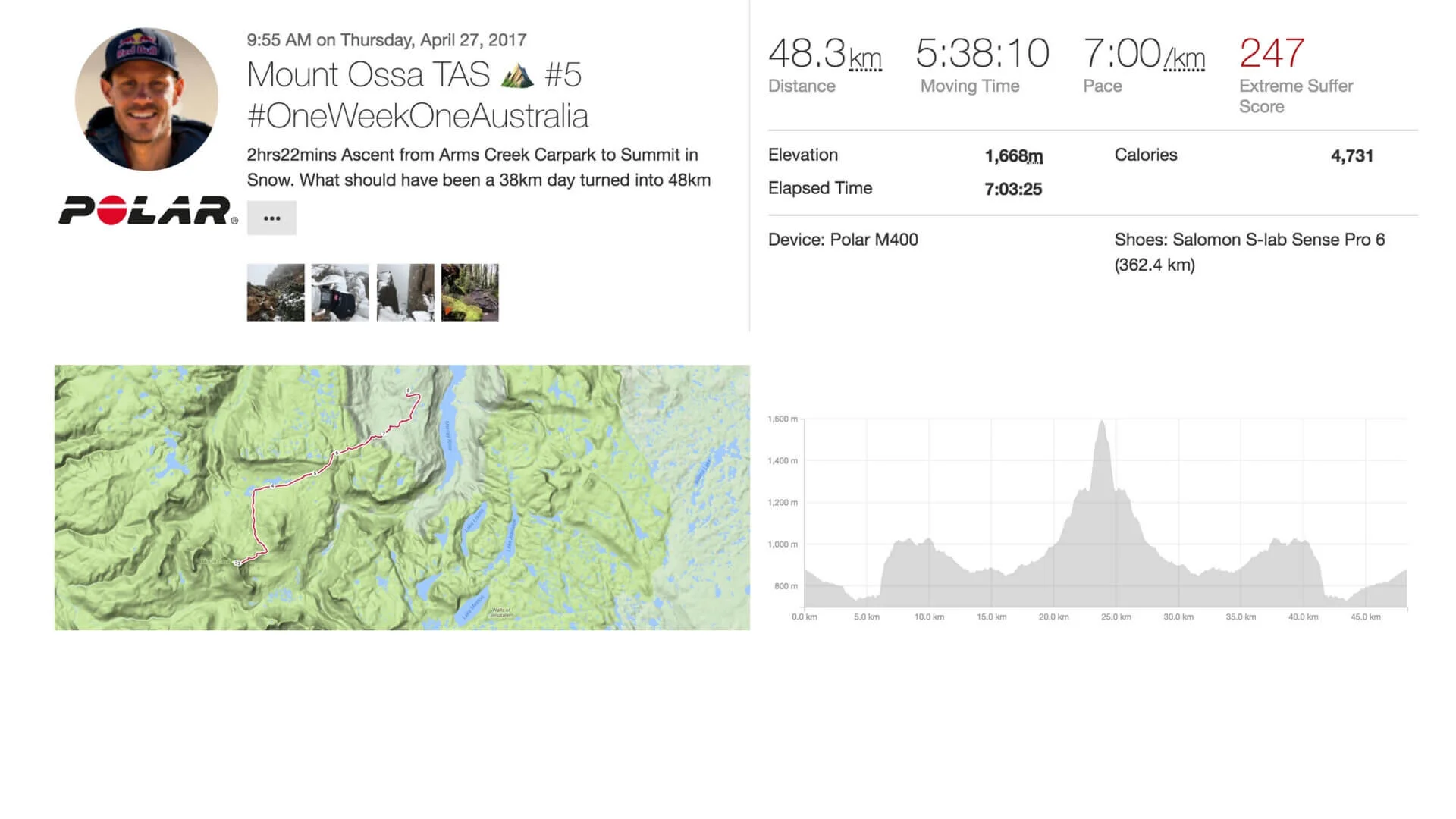
Mount Ossa GPS Strava
Location: Access via the famous "Overland Track" hiking trail near Cradle Mountain National Park, Tasmania.
Access: Fly into Launceston and drive out 2.15hrs through Mersey Forest to Arm's River Track Trail Head (last section of drive is on unsealed forestry roads)
*This is where our first major hiccup for the week occurred. Due to recent flooding, the bridges were swept away. Derooted trees across road forced an early stop 5km away from Trail Head. Adding another 10km running to a planned 38km return trip.
Sleep: In Launceston ready for a 6am flight to Perth.
Terrain: Amazing run taking in a section of the 'Overland Track'. Arms River Track is technical, hard, surprisingly hilly. Has a bit of every terrain. Overland is boggy, rooty, muddy. But once you turn right onto the climb up towards Ossa's summit it's a great track. Some duckboards but with the snow, at the top, the climbing and navigation became a bit of a challenge. Epic trail run!
Difficulty: 7/10

Courtney Atkinson's Polar M400 on Mount Ossa Tasmania
"I wanted to know how far I could push my body running the highest and harshest conditions in Australia in a limited time."
MOUNT MEHARRY
Courtney Atkinson carrying Kathmandu XT Tanker

MOUNT MEHARRY GPS STRAVA
Location:Karijini National Park in the Pilbara region Western Australia.
Access: From Perth, it's a flight into the mining town, Newman. 4x4 out 160km to the mountain's base. The final 16km was on good quality unsealed road before deteriorating into harsh 4x4 tracks close to the bottom of the mountain.
Sleep: Good old bush camping
Terrain: Rough 4x4 track right to the top. Watch out for the snakes.
Difficulty: 2/10
"7 climbs, 7 days and I saw a couple on Bimberi, 2 people on Kozi, a group of backpackers on Overland track at the base of Ossa and a whole lot of emptiness. Australia's a remote landscapes.

RUNNING MOUNT MEHARRY WESTERN AUSTRALIA
MOUNT ZEIL

Mount Zeil Camping State 8

MOUNT ZEIL GPS STRAVA
Location: Western MacDonnell Ranges, Northern Territory.
Access: Varies. 4x4 drive from Alice Springs of around 225km starting on bitumen then onto unsealed roads and paddocks.
Sleep: Good old bush camping
Terrain: No track. No running! Loose rock, razor spinifex grass, no water. Wear good gaiters and protective shoes. Running shoes are painful!

Mount Zeil Summit
Difficulty: 8/10
"Didn’t really give much thought into just how much hard running I would be doing in 7 days. They were big runs at that pace. Super taxing days by anyone's standard - biggest running week of my life"
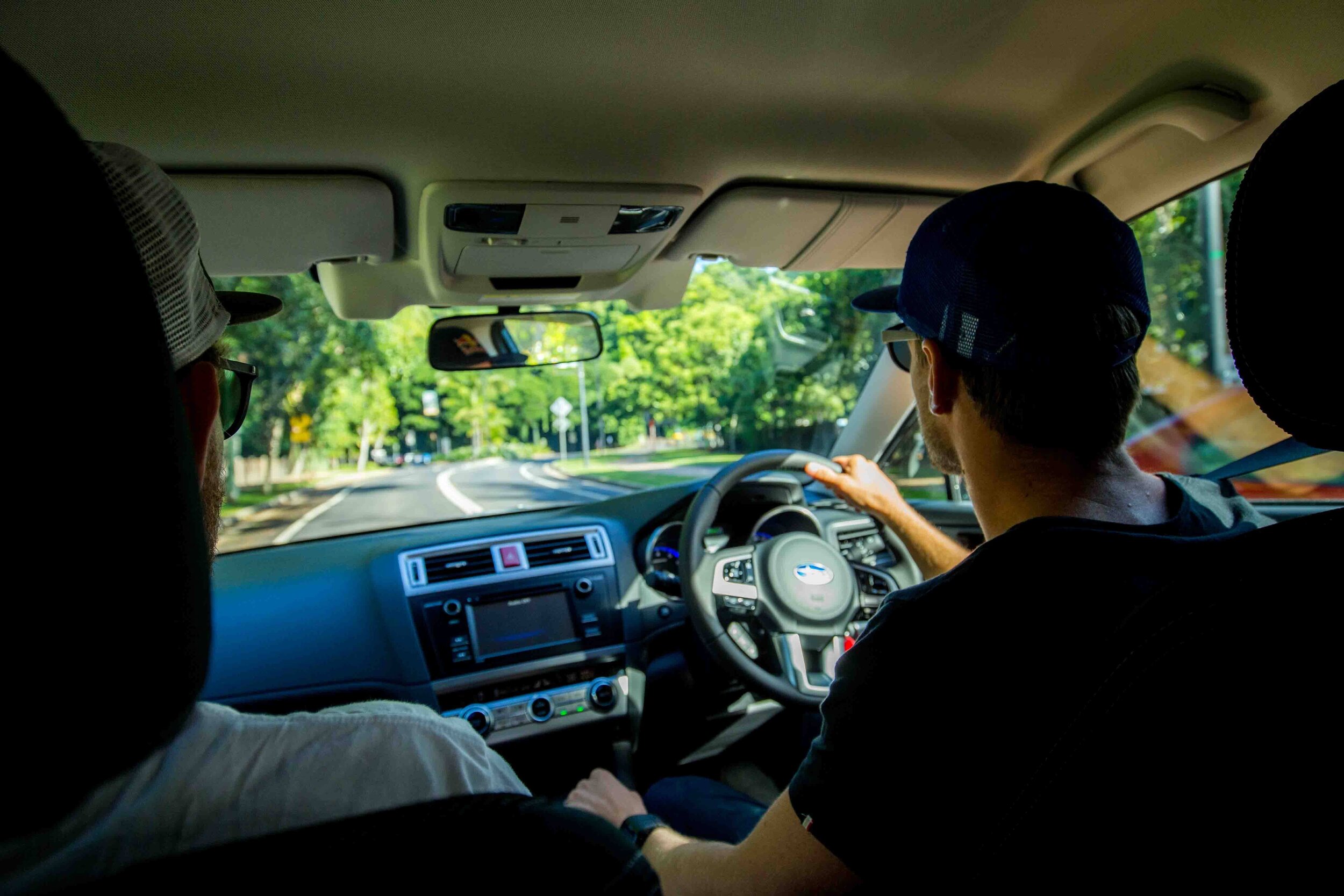
Courtney Atkinson driving Subaru around Australia